Geological Landscapes & Geosites of Ningde UNESCO Global Geopark
编辑: 小编 时间:2023-07-04 10:33:22 浏览次数:
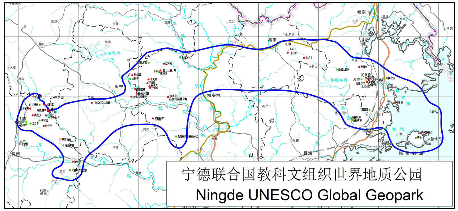
The NingdeGlobal Geopark has diverse geomorphological landscapes that are dominated by miarolitic granite, volcanic, canyon, and erosion riverbed landforms, accompanied by water, coastal, islands and marine erosion landforms. Of them, miarolitic granite landform dominates Taimushan in the Taimushanarea and Jiulongdong of the Baiyunshanarea; volcanic mountain landform mainly presents in Baishuiyang and Yiyang of the Baishuiyangareaand Baiyunshan in the Baiyunshanarea; erosional riverbed landform is seen in Baishuiyang of the Baishuiyangarea and Jiulongdong, Longtingxi of the Baiyunshanarea; and the coastal, island and marine erosion landforms occur in Qingchuan Bay and Fuyao Islands in the Taimushanarea , as well as canyon landform in Jiiulongji Gorge of Zhouning.
1. Alkali-feldspar Miarolite-formed Peak Cluster-stone Egg Landform in the Taimushan
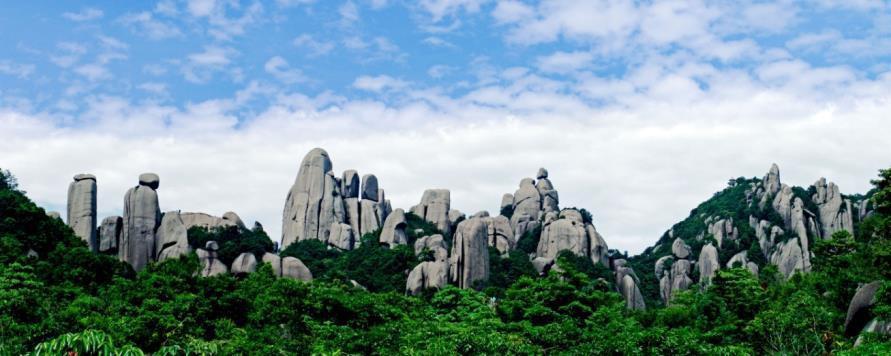
Many vertical, even and straight fractures have developed in the granitic rocks due to the process of the Earth’s stress. When these “injured” rocks moved up with the uplift of the Earth’s crust, physical and chemical weathering (rainwater dissolution, warm-induced expansion and cold-induced shrinkage) gradually enlarged the fractures and resulted in the formation of valleys. The remained rocks formed many stone peaks, i.e., granitic peak cluster-peak forest. The Huangshan Mountains of Anhui Province and the Sanqingshan Mountains of Jianxi Province are all this type of landform. Spheroid weathering resulted in some of granite to have a rounded appearance looked just like huge eggs, and thus named granitic stone egg landform. Baishiding of Taining and the Shiniu Mountains of Dehua both in Fujian Province are of this type.
The miarolitic granite-formed peak cluster-stone egg landform in the Taimushan is the best one of the granite-formed peak cluster-stone egg landforms in the coastal areas of southeastern China and thus is the typical representative of this kind of landform. Compared with other similar landforms, it has following unique characteristics: (1) the landscape-forming rock is miarolitic granite; and (2) the landform is a hybrid among sharp peak forest, peak cluster and stone egg categories.
1.1Categories of the Alkali-feldspar Miarolitic Granite Landforms in the Taimushan of Fuding
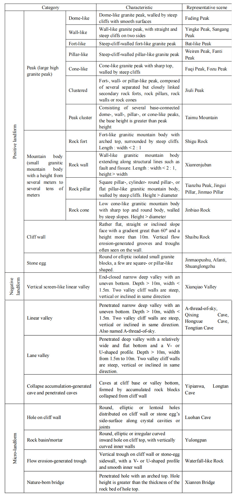
1.2 Jiulichaotian(Nine Carps Facing Sky)Peak Cluster
The cluster consists of nine tall straight peaks and pillars, vividly like nine jumping carps, and hence named Nine Carps Facing Sky. The peaks and pillars are 40~50 m high, straight upward and extremely spectacular. They are controlled by two vertical joints. One is N65°~70°E in strike. The other is SN extended(Photo 4-3). Due to the well-developed near horizontal joints, the peak tops and cliff surfaces are modified by spherical weathering, forming many vividly-shaped rocks such as Orangutan Going Down Hill and Monkey Looking the Mirror
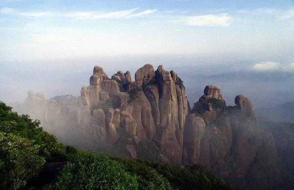
1.3 Fuqi (Husband and Wife) Peak
This is a lofty peak. Water erosion along N65°E joints in the miarolite has chopped the rock into two pillars, one is taller and the other is shorter. The top of the pillars have been shaped as eggs. When viewed from east, they look just like a couple snuggling each other, and thus called Husband and Wife Peak. But when looked from north, they like two persons in conversation, and therefore named Two Buddha Talking About Sutra. This is the sign of the s in the TaimuMountain.
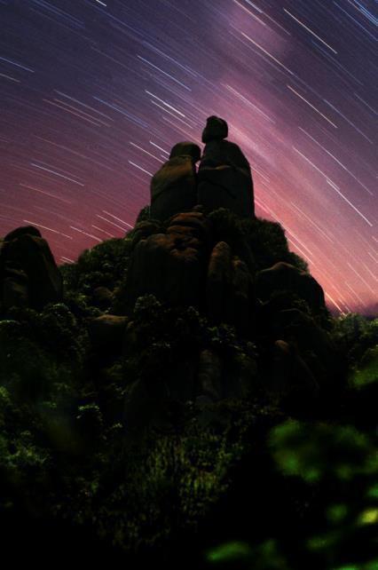
1.4 Tianzhu (Sky Pillar) Peak
This peak is a 40 m-high rock pillar. The transection of the pillar is ellipse, with a long axis of 8 m long and 3 m wide and striking N65ºE. The top of the pillar has two stone eggs. The big one looks like a bending cat and the small one like a running mouse, hence called Golden Cat Catching Mouse.
1.5 Vertical Water Erosion Grooves and Troughs
Parallel arranged vertical water erosion grooves and troughs are often seen in the cliff surfaces of the alkali-feldspar miarolitic granite in Taimushan. When viewed from remote distance, they look exactly like water falling from the sky ( Photo 8-20 ) . This scenery is also well developed in the Chan and Longting Stream areas.

1.6 Linear Valley and Lane Valley
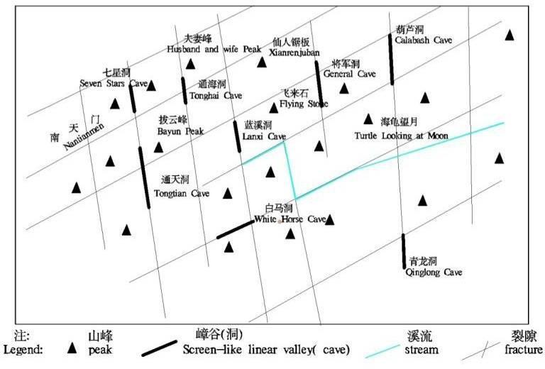
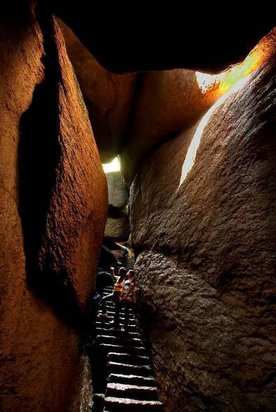
The converged vertical flows from the precipitated water have eroded and cut rock body along vertical joints on the cliff walls, forming the linear valley with straight and steep side walls. The valley is very narrow, usually 0.5 m~1.5 m wide, and has an uneven bottom. Therefore, this kind of linear valley is also called A-thread-of-Sky. The linear valley is extremely well developed in the miarolites in Taimushan. Sometimes the top of the linear valley is covered by huge fallen rock blocks, thus forming dark caves, such as Qixing (Seven Star) Cave, Tongtian (Connecting to the Sky) Cave and Hongxue Cave. This kind of dark cave forms a distinctive scene for Taimushan.
Qixing(Seven Star)Cave: The cave trends in N345°W, with a length of 40 m and a width of 0.8 m. Two valley walls are straight with a height of some 20 m and are covered with lichen. The valley bottom inclines southward. On the top of valley, seven spherical rock blocks are clamped between two valley sidewalls, similar to seven bright stars in the sky. Therefore, the cave is named Seven Star Cave.
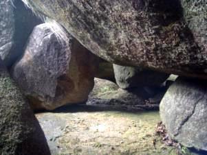
1.7 Overlaid Rock-induced Cave
This is a passable penetrated cave, formed by the huge overlaid fallen rocks of miarolite due to gravitational collapse. This kind of cave includes Sanfuyao Cave, Drip Cave (Photo 4-8), Yipianwa(A Piece of Tile)Cave, General Cave, Xuanji Cave, Bat Cave, Lotus cave, Wetuo Cave, Longtan Cave, etc. The cave can be either simple or complicated. The simple one is the Yipianwa(A Piece of Tile)Cave, while the most complex one is the Longtan Cave.
Longtan Cave: The cave is a compounded maze-like cave group, located between Qilin and Longzhu hillocks. It was formed by overlaid fallen rock blocks. The main cave body trends in N73°E, with a horizontal length of 410 m. The upper opening is 775 m above sea level, while the figure for the lower opening is 625 m. The distribution of the cave is mainly along a fault zone. The cave walls are very steep, so looked just like a fault corridor. There are many lateral secondary caves derived from the main one. They can also extend for several tens of meters. The cave can be divided into three to four floors, forming three bigger halls, 60 m2~100 m2 in area. Correspondingly, there are upper, middle and lower openings to connect three floors with the outside world. Many secondary caves with various shapes and sizes are embedded in large ones.
1.8 The Formation Process of Alkali-feldspar Miarolitic Granite in Taimushan
Initially, the primitive joints were developed in the alkali-feldspar miarolitic granites in Taimushan during magma cooling and crystallization process. The later neotectonics crust movements since Cenozoic have resulted in the development of NNE faults and the derived NEE and NNW joints and fractures in the rock body. Among them, the N65°E -extending faults, dipping 75° to 80°, are compression -shear ones, while the N345°-360°W -extending, straight standing fractures are stretching-shear ones. They are crossed each other and form the chessboard structure system (Fig. 4-1).The uplift of the Earth’s crust has moved the alkali-feldspar miarolitic granite body upward and exposed the rocks to the air. After long-term exogenetic processes, the rock body has experienced weathering, breaking off and collapse, which resulted in the formation of steep mountains. The rocks on the two sides of the NEE compression-shear faults are broken up, and therefore are the weak zone in resisting weathering and water erosion. As a result, big valleys often develop along these faults. On the other hand, the NNW stretching-shear faults have pulled apart of the rocks, forming narrow and straight valley such as linear valley or vertical screen-like linear valley. Differently-shaped broken rocks have been further modified into stone eggs after long-term weathering. The fallen rock blocks have formed various overlaid rock-induced caves in the valleys. All of these constitute the distinctive miarolitic granite-stone egg landform of Taimushan.